From pioneering wind profiles to monitoring greenhouse gases: Europe's leadership in space-borne LiDAR is a journey of precision
💡How did we get here?
Before HALLOA, several landmark missions paved the way for active sensing from space:
- Aeolus (2018-2023): The pioneer that proved LiDAR works in orbit from
- EarthCARE (since 2024): Deepening our understanding on clouds and aerosols from the European Space Agency (ESA) and the Japan Aerospace Exploration Agency (JAXA)
- MERLIN (scheduled 2029): The upcoming laser hunter for atmospheric methane from CNES and the German Aerospace Center (DLR)
Each mission is a building block. But as climate challenges evolve, so must our technology. That’s where HALLOA comes in, not a single satellite mission, but as the core technology for the next generation of LiDAR climate observers.
Measuring CO2, H2O and wind with HALLOA's LiDAR
💡How will our team transform a laser beam into an atmosphere diagnostic tool?
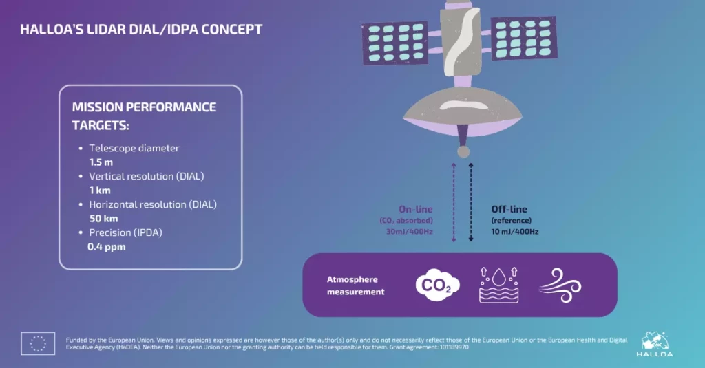
At the heart of the HALLOA mission lies the DIAL/IPDA technique.
It’s about emitting light with extreme precision in a severe space environment.
By sending laser pulses at two distinct wavelengths, we can read the atmospheric column with surgical accuracy:
🌠 one absorbed by CO2
🌠 one serving as a reference
Check out HALLOA’s mission definition as our team already finalised it ⬇️
Measuring CO2, H2O and wind requires a robust laser
💡How will our laser be able to hit CO2, H2O absorption lines with maximum efficiency?
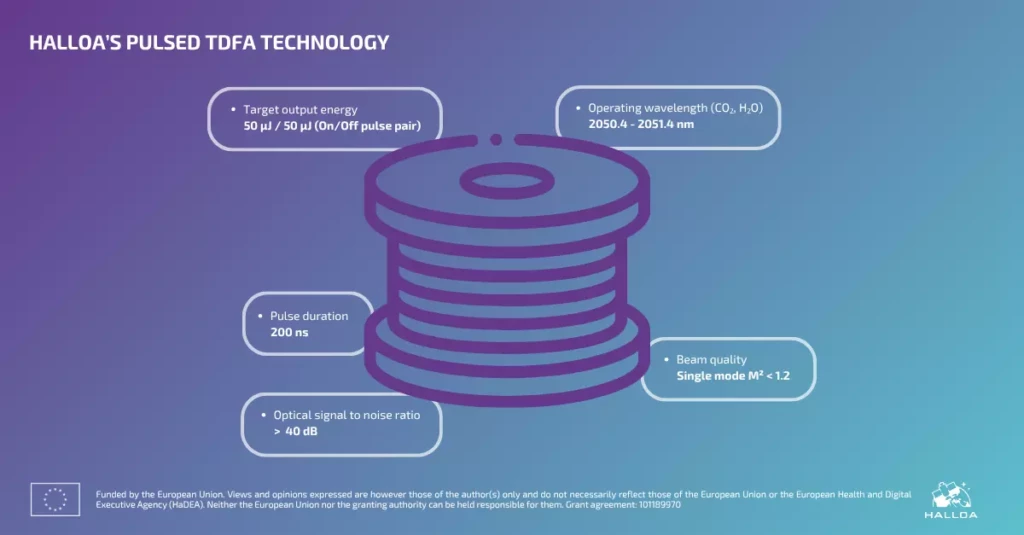
At the heart of the HALLOA mission, one instrument is the key to measure with extreme accuracy the data we need to understand climate: the pulsed fiber Thulium-Doped Fiber Amplifier (TDFA).
Operating in the 2µm domain, our TDFA will make our mission possible.
Check out HALLOA’s TDFA specificities ⬇️