How does LIDAR work? From light pulses to atmospheric data
LIDAR stands for Light Detection And Ranging. It is a technology similar to radar, but instead of radio waves, LIDAR uses a laser beam. While radar measures with radio waves, LIDAR measures with light.
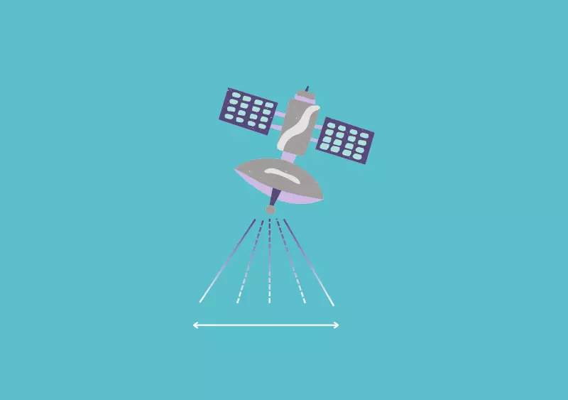
The operating principle is straightforward. LIDAR sensors send light pulses through the atmosphere. The emitted light interacts with atmospheric constituents and is scattered back toward the sensor. The returned light holds atmospheric data that can be analysed to retrieve information about distance, structure, and composition.
Thanks to this principle, LIDAR is used in many application fields. In atmospheric science, it enables the monitoring of atmospheric composition, temperature, and structure to better understand climate change evolution. In archaeology, it reveals hidden structures beneath vegetation and produces high‑resolution terrain models without excavation. In forestry, it measures canopy height, biomass, and gaps to monitor forest health, biodiversity, and carbon stocks. LIDAR is also widely used for wind monitoring, capturing wind profiles and dynamics to optimise wind power exploitation, study atmospheric dynamics for weather forecasting, or identify wake vortices around airports.

Space versus terrestrial LIDAR: same physics, different realities
Space LIDAR and terrestrial LIDAR rely on the same physical principles, but they operate in very different conditions and serve different purposes.
Space LIDAR enables global‑scale monitoring, while terrestrial LIDAR provides local measurements. From orbit, measurements are limited by a low overpass frequency at the same position, whereas ground‑based systems can perform continuous measurements, but only at a fixed location.
There are also major differences in performance. Space LIDAR generally has low or no range resolution, while terrestrial LIDAR can achieve high range resolution. These differences directly influence the type of scientific questions that can be addressed.
The operating environments further set the two approaches apart. Spaceborne instruments must withstand high vibrations and shocks during launch, radiation exposure, and extreme temperature variations. Once in orbit, no maintenance is possible. Terrestrial systems, by contrast, experience smoother vibrations during transportation, no radiation, and low to moderate temperature variations, and they can be maintained or upgraded over time.
These constraints lead to different technical laser requirements. Space lasers are most often pulsed lasers, operating at a low repetition rate due to the satellite–atmosphere–ground round‑trip time. They require high energy to cover long distances. Terrestrial lasers can operate with variable repetition rates, depending on the required range and time resolution, and with low to high energy depending on the application.
Why space LIDAR needs powerful laser amplification
Space is far. For a space‑based LIDAR system, the return echo from the atmosphere or the Earth’s surface is extremely weak and easily hidden by noise, such as random background light. This is one of the main technical challenges of space LIDAR.
The solution is laser amplification. An amplifier allows the system to go farther by boosting the laser pulses so they survive the long journey from space to the Earth and back. It also helps to hear better, by raising tiny echoes above the noise. Ultimately, amplification makes it possible to measure more cleanly, improving the signal‑to‑noise ratio and enabling more accurate distance and atmospheric measurements.
A laser itself is based on Light Amplification by Stimulated Emission of Radiation. The laser beam consists of pure light of a single colour, produced by the interaction of matter with light through a process known as stimulated emission.

HALLOA’s challenge and technological ambition
The ambition of the HALLOA project is to design an innovative European space‑based LIDAR capable of measuring carbon dioxide (CO₂), water vapour (H₂O), and wind speed from space.
To meet the stringent requirements of a space laser source, HALLOA is developing a hybrid laser architecture. This approach synergistically combines two technologies. The fibre amplifier offers excellent optical properties, alignment‑free operation, and high versatility. The free‑space amplifier enables high power with lower complexity compared to free‑space oscillators. Together, they form a hybrid amplifier concept tailored for space‑borne LIDAR applications.
HALLOA’s space‑based LIDAR will use a differential absorption method in the 2.05 μm spectral region, a key wavelength for greenhouse gas sensing. By combining advanced laser technologies with space‑qualified design, the project aims to improve our ability to monitor greenhouse gases and atmospheric dynamics on a global scale.

A European project for climate monitoring from space
With a budget of €2.7 million, the HALLOA project (2025–2027) brings together six European partners around a common goal: monitoring greenhouse gases from space using advanced LIDAR and laser technologies.
Funded by the European Union, HALLOA contributes to the development of European expertise in space‑based atmospheric monitoring, supporting a better understanding of climate change and the tools needed to address it.